|
|
| Related Items: |
 Early
road map of Alberta, 1922 Early
road map of Alberta, 1922
|
 Motor
roads in western Canada, ca. 1928 Motor
roads in western Canada, ca. 1928 |
|
|
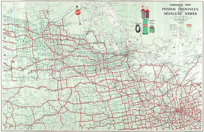
Highways map of the prairie
provinces
1931, by Imperial Oil Limited
This 1931 highway map shows the developing network
of roads across western Canada. For example, highway
connections to the United States are scattered across
the southern Prairies; however, similar connections
to the rest of Canada through northwestern Ontario are
noticeably absent. The reverse side of the map features
items of general interest to a traveller, in particular
information on accommodation, recreational possibilities,
and driving tips.
|